
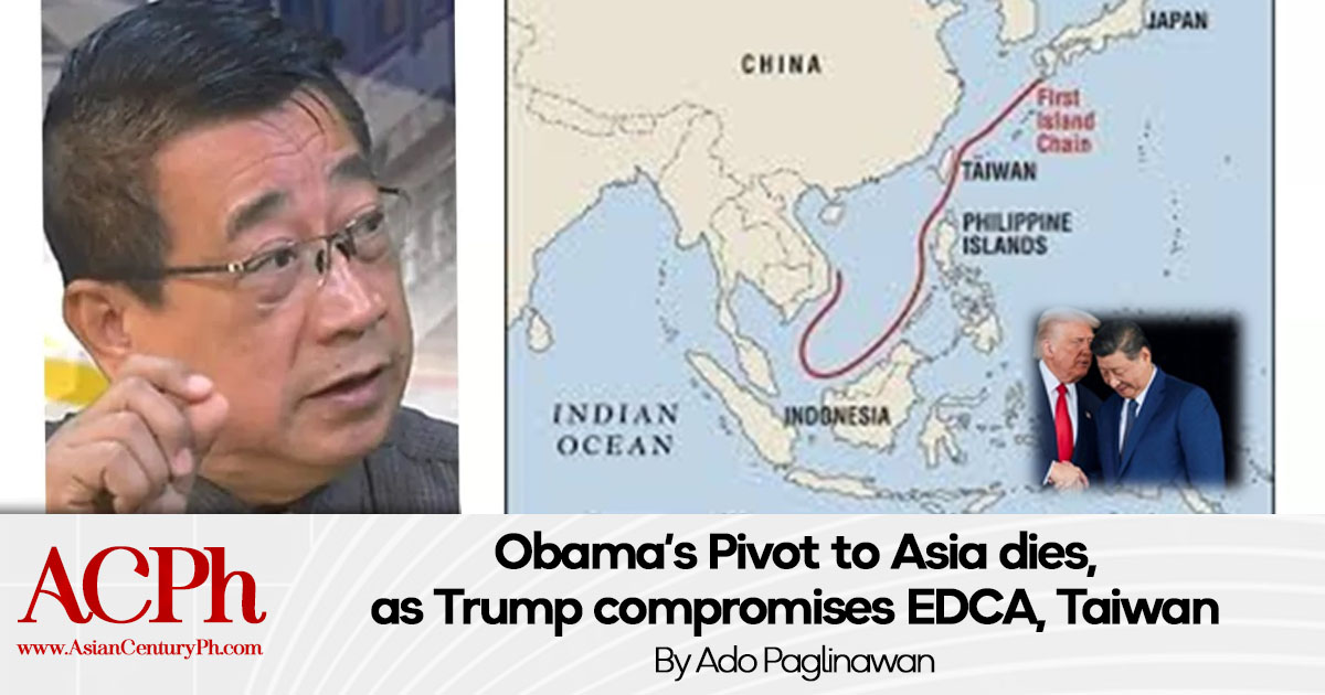
Part One of Two: Delusions of Grandeur Clouds Foreign Policy
Former Associate Justice Antonio Carpio praised President Ferdinand R. Marcos Jr. for articulating that Philippine territory is not limited to islands within the 1898 Paris treaty lines.
What a farce!
Carpio said this corrected what he called the “greatest misconception” about Philippine territory.
What a double farce!
“This is the first time that a Philippine President has stated that Philippine territory is defined by the 1898 Treaty of Paris, as clarified by the 1900 Treaty of Washington, which stated that Philippine territory includes all islands of the Philippine archipelago lying outside the lines of the Treaty of Paris,” he said.
What a colossal farce!
The Treaty of Washington of 1900 was signed on November 7, 1900, and came into effect on March 23, 1901, upon exchange of ratifications. The treaty sought to remove any ground of misunderstanding growing out of the interpretation of Article III of the 1898 Treaty of Paris by clarifying specifics of territories relinquished to the United States by Spain.
It explicitly provided:
“Spain relinquishes to the United States all title and claim of title, which she may have had at the time of the conclusion of the Treaty of Peace of Paris, to any and all islands belonging to the Philippine Archipelago, lying outside the lines described in Article III of that Treaty and particularly to the islands of Cagayan [Mapun], Sulu and Sibutu and their dependencies, and agrees that all such islands shall be comprehended in the cession of the Archipelago as fully as if they had been expressly included within those lines.”
In consideration for explicit statement of relinquishment, the United States agreed to pay to Spain the additional sum of one hundred thousand dollars ($100,000).
Cunning overreach
Carpio deliberately twisted the treaty provision.
The islands referred to are those which Spain had all titles and claim of title which she may have at the time of the conclusion of the 1898 treaty, but which were left off in its Article III of the Treaty of Paris two years earlier when the US bought the Philippine Islands from Spain for twenty million dollars.
Particularly referred to were the islands of Cagayan de Sulu and Sibutu and their dependencies. These islands are in the southern extreme of the Philippines before the limits set by a third treaty, the 1930 Convention Treaty between the US and Britain, demarcating the boundaries between Sabah and the Philippines.
Carpio pontificates that the Treaty of Washington meant to include “Panacot” reflected in his 1734 Velarde Map, later referred to as Bajo de Masinloc by Spanish, Panatag by Filipinos and Scarborough by the British. He doesn’t substantiate his claim by any proof of title or claim of title by Spain.
His logic is megalomaniac – it was not included therefore, it is included. He insists “This is factually, legally, and historically correct.” How? Only he knows.
But the retired magistrate seems to have convinced a second fool.
President Marcos, during his policy speech at the IISS Shangri-La Dialogue in Singapore, referred to both the Treaty of Paris and the Treaty of Washington as the basis of the country’s territorial scope.
The former is correct, the latter is a wild stretch of imagination. The logical flow is “I said so therefore, it is!” Dios mio, it seems that the American “rules-based order” syndrome has infect our presidency as he presses on:
“When we established our Commonwealth in 1935, we put together a constitution that defined our territory in accordance with the international treaties that became the basis of our archipelagic unity, The Treaty of Paris between Spain and the United States crystallized our islands into a cohesive whole.”
There is no question about that.
But when he added – “The Treaty of Washington clarified (that) the extent of our sovereignty and (our) patrimony (transcends the) lines set by international powers” – the President was already improvising. This second treaty (Washington) merely adds to the particulars that were left out by the first treaty (Paris).
The two treaties were a real estate transaction where specificity is essential. That is why there is a bill of particulars that goes with the agreement.
But Carpio remains bullheaded, “This finally corrects the greatest misconception in Philippine history that Philippine territory is limited to the islands within the Paris Treaty lines… A watershed moment in our fight to defend our island territories and maritime zones in the West Philippine Seas.” If Carpio and the President insist on their theory then they must produce proof as in any document showing titles or claim of titles to any other features they wish to include.

But in asserting this foolish theory supporting Marcos’ “ruled-based order” statement, Carpio not only misrepresents the three treaties mentioned that and the limits they established as part of our historic rights, but he has gone to mock three legal luminaries.
The former magistrate said that Joaquin Bernas, Estelito Mendoza and Juan Ponce Enrile were wrong in saying that it was only in 1978 when the Philippines started asserting new territories, alluding to former President Marcos’ Decree 1596 claiming eleven features of the South China Seas in the Spratly area.
So what does Carpio do? He returns to his Velarde Map, a cartography by a Spanish friar done in 1734 and to his theory that the inclusion of “Panacot” therein meant that the feature was part of the Philippines. Panacot is now also known as Panatag in Pilipino, aka Bajo de Masinloc in Spanish and or Scarborough Shoals in British.
Is he even aware of the complications that he is creating?

While he stretches imagined historic rights from the Treaty of Washington, has he forgotten that on a separate occasion, he has ignored historic rights of a neighboring country such as China. While he asserts China’s nine-dash-line map has no legal basis, he submits the Velarde Map to grab “Panacot”.
Carpio also has to explain the implications the inclusion of “Borney” in that map that also indicated “Monte de San Pedro”. If by his wild wonderings, Panacot is ours, then Borneo should also be ours.
But which Borney? The Velarde Map does not distinguish.
North Borneo can be Sabah or Sarawak. The rest of Borneo is Kalimantan. Sabah is now under the sovereignty of Malaysia but claimed by the Philippines in behalf of the Sultanate of Sulu. Sarawak is also under the sovereignty of Malaysia, but had an earlier claim by Indonesia. Kalimantan is under the sovereignty of Indonesia.
Are we expanding our territorial disputes now to pester Malaysia and Indonesia, on top of our problem with China in the South China Seas? That will happen if you consider maps as any authority in matters of sovereignty and not just a piece of paper.
As I have earlier said, the same will also rebound to reconsidering the “nine-dash line” map of China because what is good for the goose must be good for the gander. When we do that we would be contradicting our opposition to the nine-dash line and validating China.
So are we still thinking normally at this stage?
Spratlys, left behind
The Spratlys are not even reflected in the same Velarde Map.
Inclusion of Scarborough and the Spratlys may however, be already late in the day. Both do not qualify for either delineations for internal waters or archipelago under the United Nations Convention of the Law of the Sea.
That Scarbough and Spratlys cannot qualify as internal waters, is easily proven by the naked eye, just by looking at the map. There is no land formation engulfing it. Scarborough cannot conform to an archipelagic configuration as it is already 124 nautical miles off the Zambales baseline, and worse, outside of the limits demarcated by the Treaty of Paris.
The archipelagic nature of the entire Philippines is sustained by Article 46 by UNCLOS and Paragraphs 573 of the 2016 Arbitral Award (on PCA Case Nº 2013-19), Its applicability to the Spratlys, however, is denied in Article 47 and Paragraph 574.
“573. The use of archipelagic baselines (a baseline surrounding an archipelago as a whole) is strictly controlled by the Convention, where Article 47(1) limits their use to “archipelagic states”. Archipelagic States are defined in Article 46 as States “constituted wholly by one or more archipelagos and may include other islands.” The Philippines is an archipelagic State (being constituted wholly by an archipelago), is entitled to employ archipelagic baselines, and does so in promulgating the baselines for its territorial sea.
“574. In any event, however, even the Philippines could not declare archipelagic baselines surrounding the Spratly Islands. Article 47 of the Convention limits the use of archipelagic baselines to circumstances where “within such baselines are included the main islands and an area in which the ratio of the area of the water to the area of the land, including atolls, is between 1 to 1 and 9 to 1.”599 The ratio of water to land in the Spratly Islands would greatly exceed 9:1 under any conceivable system of baselines.”
The final blow was rendered by our own Republic Act 9522 redefining the archipelagic polygon established by claims for the Kalayaan Island Group made by President Ferdinand Edralin Marcos in 1978 under his Presidential Decree 1596, onto converting it to the UNCLOS delineation of a “regime of islands”. This was further negated by the clarification of the 2016 Arbitral Award that our claimed features are not islands, but “rocks”. UNCLOS does not provide for a regime of rocks.
Distinguished lawyers led by UP Dean Merlin Magallona, petitioned the Supreme Court to declare RA9522 unconstitutional because of the substantial changes it was doing just to conform the Philippines to UNCLOS in order to capture what would be a larger “exclusive economic zone” projecting 200 nautical miles from our baselines.
The petition marked that we were defining our baselines first in disregard to our treaty limits inherited from the United States, thus losing sovereignty and territorial sea and too close a shave to our shores and internal waters in order to gain sovereign rights up to 200 nm of exclusive economic zone (EEZ).
Sovereignty is acquiring what is under the sea through the seabed, and everything over the waters and the aerospace above them. Sovereign rights pertain only to harnessing what is under the sea for a country’s economic benefit, while the surface of the waters and the aerospace above them remain to be international waters, there is no ownership involved.
As a result, we might have already lost 830,140 square kilometers of sovereignty and territorial waters from our inherited treaty limits, and about 70,000 sqkms for our dismantled claim on the KIG polygon.
The Supreme Court ruled PD9522 as “not unconstitutional”. In its decision over case GR 187167.
I will give you a single guess who the ponente was of that Supreme Court ruling.
Antonio Carpio.
Regime of lawyers
The retired magistrate has only one strategy towards China – legalism. His weakness is that despite his stint at the Supreme Court he still performs like a privately-practicing lawyer whose reflexes have been honed to look for loopholes and cherry-pick for alternatives to suit his client’s advantage.
Only July 2013, following our loss of Scarborough to China following the mismanagement of a standoff by President BS Aquino and Foreign Affairs Secretary Albert del Rosario and preluding to the filing of arbitration proceedings against China, Professor (now emeritus) Carl Thayer of the University of New South Wales at the Australian Defence Force Academy clarified “Maps, in international law, are only pieces of information. The key to sovereignty is to demonstrate long-standing continuous occupation and administration over features in the South China Sea.”
Marcos can be excused. He is not a lawyer. He is just a dropout.
But both are ignorant of the role of customary law in international relations. So they superimpose themselves in a discipline better left to diplomats.
Diplomacy 101’s first test question to Marcos and Carpio – who is now in effective control of the Spratlys and the Scarborough Shoals?
Definitely not the Philippines.
To be continued. Next: Implications of the Mutual Defense Treaty

Adolfo Quizon Paglinawan
is former diplomat who served as press attaché and spokesman of the Philippine Embassy in Washington DC and the Philippines’ Permanent Mission to the United Nations in New York from April 1986 to 1993. Presently, he is vice-president for international affairs of the Asian Century Philippines Institute, a geopolitical analyst, author of books, columnist, a print and broadcast journalist, and a hobby-organic-farmer.
His best sellers, A Problem for Every Solution (2015), a characterization of factors affecting Philippine-China relations, and No Vaccine for a Virus called Racism (2020) a survey of international news attempting to tracing its origins, earned for him an international laureate in the Awards for the Promotion of Philippine-China Understanding in 2021. His third book, The Poverty of Power is now available – a historiography of controversial issues of spanning 36 years leading to the Demise of the Edsa Revolution and the Forthcoming Rise of a Philippine Phoenix.
Today he is anchor for many YouTube Channels, namely Ang Maestro Lectures @Katipunan Channel (Saturdays), Unfinished Revolution (Sundays) and Opinyon Online (Wednesdays) with Ka Mentong Laurel, and Ipa-Rush Kay Paras with former Secretary Jacinto Paras (Tuesdays and Thursdays). His personal vlog is @AdoPaglinawan.

This promo includes free delivery by JRS to anywhere in the Philippines.
Email: contact@asiancenturyph.com
Facebook: https://www.facebook.com/asiancenturyph/
Twitter: https://twitter.com/AsianCenturyPH
Substack:
Also read:


Leave a Reply